
ファイル:Saint Paul Island Alaska aerial view.jpg

このプレビューのサイズ: 800 × 523 ピクセル。 その他の解像度: 320 × 209 ピクセル | 640 × 419 ピクセル | 1,024 × 670 ピクセル | 1,500 × 981 ピクセル。
元のファイル (1,500 × 981 ピクセル、ファイルサイズ: 589キロバイト、MIME タイプ: image/jpeg)
ウィキメディア・コモンズのファイルページにある説明を、以下に表示します。
|
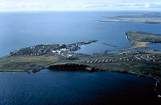
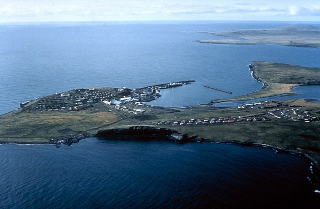
| 解説 | Aerial view of St. Paul Island | |||
| 場所 | St. Paul Island, Alaska, USA |
|||
| 日付 | not specified or unknown | |||
| 原典 |
U.S. Army Corps of Engineers Digital Visual Library Image page Image description page Digital Visual Library home page |
|||
| 作者 | U.S. Army Corps of Engineers, photographer not specified or unknown | |||
| 許可 (ファイルの再利用) |
|
| カメラの位置 | | 以下のサービスでこの位置を確認する: オープンストリートマップ |
|---|
| 被写体の位置 | | 以下のサービスでこの位置を確認する: オープンストリートマップ |
|---|
ファイルの履歴
過去の版のファイルを表示するには、その版の日時をクリックしてください。
| 日付と時刻 | サムネイル | 寸法 | 利用者 | コメント | |
|---|---|---|---|---|---|
| 現在の版 | 2007年3月20日 (火) 01:44 | | 1,500 × 981 (589キロバイト) | DanMS | {{Information | Description = Aerial view of St. Paul Island | Source = U.S. Army Corps of Engineers Digital Visual Library<br />[http://images.usace.army.mil/images/Hires/4414-19.Jpg Image page]<br />[http://images.usace.army.mil/scripts/PortW |
ファイルの使用状況
以下のページがこのファイルを使用しています:
グローバルなファイル使用状況
以下に挙げる他のウィキがこの画像を使っています:
- az.wikipedia.org での使用状況
- be.wikipedia.org での使用状況
- br.wikipedia.org での使用状況
- ceb.wikipedia.org での使用状況
- de.wikipedia.org での使用状況
- en.wikipedia.org での使用状況
- es.wikipedia.org での使用状況
- fi.wikipedia.org での使用状況
- fr.wikipedia.org での使用状況
- gl.wikipedia.org での使用状況
- pt.wikipedia.org での使用状況
- ru.wikipedia.org での使用状況
- www.wikidata.org での使用状況
- zh.wikipedia.org での使用状況