
ファイル:StSimonsMap.jpg

このプレビューのサイズ: 800 × 567 ピクセル。 その他の解像度: 320 × 227 ピクセル | 640 × 454 ピクセル | 1,024 × 726 ピクセル | 1,151 × 816 ピクセル。
元のファイル (1,151 × 816 ピクセル、ファイルサイズ: 267キロバイト、MIME タイプ: image/jpeg)
ウィキメディア・コモンズのファイルページにある説明を、以下に表示します。
|
概要
| 解説 |
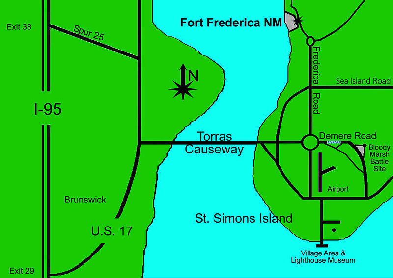
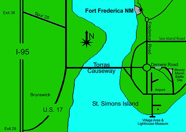
English: Map showing part of St. Simons Island |
| 原典 | US National Park Service http://www.nps.gov/fofr/planyourvisit/bloodymarshunit.htm |
| 作者 | US National Park Service |
ライセンス
| This image or media file contains material based on a work of a National Park Service employee, created as part of that person's official duties. As a work of the U.S. federal government, such work is in the public domain in the United States. See the NPS website and NPS copyright policy for more information. |
元のアップロードログ
en.wikipedia からコモンズに Fredlyfish4 によって CommonsHelper を用いて移動されました。
元のファイルページはこちら。以下の利用者は全てen.wikipediaに属します。
- 2010-02-21 05:32 Bubba73 1151×816× (273545 bytes) {{Information |Description = Map showing part of [[St. Simons Island]] |Source = NPS http://www.nps.gov/fofr/planyourvisit/bloodymarshunit.htm |Date = ~~~~~ |Author = US National Park Service |Permission = |other_ve
ファイルの履歴
過去の版のファイルを表示するには、その版の日時をクリックしてください。
| 日付と時刻 | サムネイル | 寸法 | 利用者 | コメント | |
|---|---|---|---|---|---|
| 現在の版 | 2012年10月8日 (月) 18:23 | | 1,151 × 816 (267キロバイト) | File Upload Bot (Magnus Manske) | Transfered from en.wikipedia by User:Fredlyfish4 using CommonsHelper |
ファイルの使用状況
以下のページがこのファイルを使用しています:
グローバルなファイル使用状況
以下に挙げる他のウィキがこの画像を使っています:
- en.wikipedia.org での使用状況