
ファイル:USACE Santa Rosa Lake and Dam.jpg

このプレビューのサイズ: 800 × 533 ピクセル。 その他の解像度: 320 × 213 ピクセル | 640 × 427 ピクセル | 1,024 × 683 ピクセル | 1,500 × 1,000 ピクセル。
元のファイル (1,500 × 1,000 ピクセル、ファイルサイズ: 971キロバイト、MIME タイプ: image/jpeg)
ウィキメディア・コモンズのファイルページにある説明を、以下に表示します。
|
| 解説 |
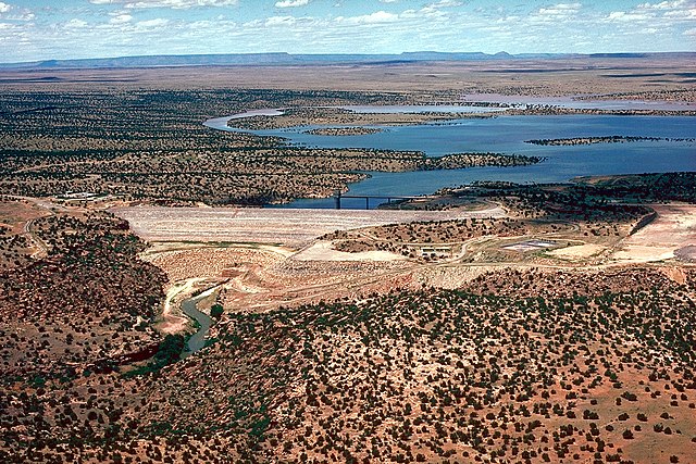
English: Santa Rosa Dam and Santa Rosa Lake (reservoir) on the Pecos River — in Guadalupe County, New Mexico, USA.
Coordinates: 35°1′42.48″N 104°41′18.62″W / 35.0284667°N 104.6885056°W
|
|||
| 日付 | (Caveat: Dates provided by U.S. Army Corps of Engineers Digital Visual Library are not reliable and may be wrong.) | |||
| 原典 |
U.S. Army Corps of Engineers Digital Visual Library Image page Image description page Digital Visual Library home page |
|||
| 作者 | U.S. Army Corps of Engineers, photographer not specified or unknown | |||
| 許可 (ファイルの再利用) |
|
ファイルの履歴
過去の版のファイルを表示するには、その版の日時をクリックしてください。
| 日付と時刻 | サムネイル | 寸法 | 利用者 | コメント | |
|---|---|---|---|---|---|
| 現在の版 | 2007年5月2日 (水) 04:37 | | 1,500 × 1,000 (971キロバイト) | DanMS | {{Information | Description = {{en|Santa Rosa Dam and Lake on the Pecos River in Guadalupe County, New Mexico, USA. The dam is located approximately 7 miles (11.2 km) north of the city of Santa Rosa, New Mexico. The U.S. Army Corps of Engineers constru |
ファイルの使用状況
以下のページがこのファイルを使用しています:
グローバルなファイル使用状況
以下に挙げる他のウィキがこの画像を使っています:
- arz.wikipedia.org での使用状況
- ceb.wikipedia.org での使用状況
- da.wikipedia.org での使用状況
- de.wikipedia.org での使用状況
- en.wikipedia.org での使用状況
- en.wikivoyage.org での使用状況
- es.wikipedia.org での使用状況
- fr.wikipedia.org での使用状況
- no.wikipedia.org での使用状況
- pt.wikipedia.org での使用状況
- ru.wikipedia.org での使用状況
- www.wikidata.org での使用状況